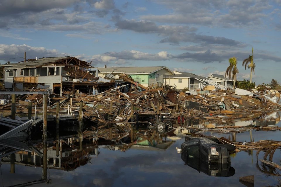
As bore down on Florida, normally reliable computer forecast models couldn’t agree on where the killer storm would land. But government meteorologists are now figuring out what went wrong — and right.
Much of the forecasting variation seems to be rooted in cool Canadian air that had weakened a batch of sunny weather over the East Coast. That weakening would allow Ian to turn eastward to Southwest Florida instead of north and west to the Panhandle hundreds of miles away.
The major American computer forecast model -- one of several used by forecasters -- missed that and the error was “critical,” a National Oceanic and Atmospheric Administration postmortem of computer forecast models determined Thursday.
“It’s pretty clear that error is very consequential,” said former NOAA chief scientist Ryan Maue, now a private meteorologist who wasn’t part of NOAA's postmortem.
Still, meteorologists didn’t miss overall with their official Hurricane Ian forecast. Ian’s eventual southwestern Florida landfall was always within the “cone of uncertainty” of the National Hurricane Center’s forecast track, although at times it was on the farthest edge.
But it wasn’t that simple. Computer forecast models, which weeks earlier had agreed on where was going, were hundreds of miles apart as Ian chugged through the Caribbean.
The normally reliable American computer model, which had performed better than any other model in 2021 and was doing well earlier in the year, kept forecasting a Florida Panhandle landfall while the European model -- long a favorite of many meteorologists — and the British simulation were pointing to Tampa or farther south.
Trying to avoid what meteorologists call the dreaded “windshield wiper effect” of dramatic hurricane path shifts, the official NOAA forecast stayed somewhere in between. Tampa — with lots of people and land vulnerable to gigantic storm surges — seemed to be the center of possible landfalls, or even worse just south of the eye so it would get the biggest surge.
Although people's fears focused on Tampa, Ian didn’t.
The storm made landfall 89 miles (143 kilometers) to the south in Cayo Costa. For a large storm, that’s not a big difference and is within the 100-mile (161-kilometer) error bar NOAA sets. But because Tampa was north of the nasty right-side of the hurricane eye, it was spared the biggest storm surge and rainfall.
People wondered why the worst didn't happen. There are meteorological, computer and communications reasons.
Overall, the European computer model performed best, the British one had the closest eventual Florida landfall but was too slow in timing and the American model had the highest errors when it came to track, NOAA’s Alicia Bentley said during the agency’s postmortem. But the American model was the best at getting Ian’s strength right, she said.
University of Albany meteorology professor Brian Tang said he calculated the American model’s average track error during Ian at 325 miles (520 kilometers) five-days out, while the European model was closer to 220 miles (350 kilometers).
“A lot of what we notice in the public is when there are big misses and those big misses affect people in populated areas,” Tang said in an interview.
Although this is technically not a miss, people who evacuated Tampa may think it is because the Fort Myers area got the brunt of the storm.
In some ways people are spoiled because the average track error in hurricane forecasts have gotten so much better. The three-day official forecast error was cut nearly in half over the last 10 years from 172 miles (278 kilometers) to 92 miles (148 kilometers), Tang said.
For years meteorologists touted the European model as better, because it uses more observations, is more complex but also takes longer to run and comes out later than the American one, Tang said. The American model has improved after a big boost of NOAA spending, but so has the European one, he added.
The models use a similar physics formula to simulate what happens in the atmosphere. They usually rely on the same observations, more or less. But where they differ is how all those observations are put into the computer models, what kind of uncertainties are added and the timing of when the simulation starts, said University of Miami’s Brian McNoldy.
“You are guaranteed to end up differently,” McNoldy said.
It’s not a problem if the models show similar tracks. But if they are widely different, as during Ian, “that makes you nervous,” he said.
People wrongly focus on funnel-like cone for where the hurricane is forecast to go instead of what it will do in specific locations, said MIT meteorology professor Kerry Emanuel. And in the cone people only pay attention to the middle line not the broader picture, so Emanuel and McNoldy want the line dropped.
Another problem meteorologists say is that the cone is only where the storm is supposed to be with a 100-mile (161-kilometer) error radius, but when storms are big like Ian, their impacts of rain, surge and high wind will easily hit outside the cone.
“The cone was never intended to convey the actual impacts. It was only intended to convey the tracks,” said Gina Eosco, who heads a NOAA social science program that tries to improve storm communications.
So for the first time, NOAA surveyed Florida, Georgia and South Carolina residents before Ian hit and will follow up after to see what risks the public perceived from the media and government information. That will help the agency decide if it has to change its warning messaging, Eosco said.
___
Follow AP’s climate and environment coverage at
___
Follow Seth Borenstein on Twitter at
___
Associated Press climate and environmental coverage receives support from several private foundations. See more about AP’s climate initiative . The AP is solely responsible for all content.
Seth Borenstein, The Associated Press


